EFTA LTD

EFTA LTD
MIKOPO YA MASHINE BILA DHAMANA

SMS & EMAIL MARKETING

SMS & EMAIL MARKETING
CALL FOR SERVICES 0762 461 460

TANAKI TOURS AND SAFARIS

TANAKI TOURS AND SAFARIS

EQUIPMENT LOAN WITHOUT COLLATERAL

EQUIPMENT LOAN WITHOUT COLLATERAL

CHOOSE YOU CATEGORY OF CHOICE HERE.

Friday, May 7, 2010

The pride of Tanzania

Ngorongoro Crater

The Ngorongoro Crater is often called ‘Africa’s Eden’ and the ‘8th Natural Wonder of the World,’ a visit to the crater is a main drawcard for tourists coming to Tanzania and a definite world-class attraction. Within the crater rim, large herds of zebra and wildebeest graze nearby while sleeping lions laze in the sun.


At dawn, the endangered black rhino returns to the thick cover of the crater forests after grazing on dew-laden grass in the morning mist.

Just outside the crater’s ridge, tall Masaai herd their cattle and goats over green pastures through the highland slopes, living alongside the wildlife as they have for centuries.

 Ngorongoro Conservation Area includes its eponymous famous crater, Olduvai Gorge, and huge expanses of highland plains, scrub bush, and forests that cover approximately 8300 square kilometres.

A protected area, only indigenous tribes such as the Masaai are allowed to live within its borders.


Lake Ndutu and Masek, both alkaline soda lakes are home to rich game populations, as well as a series of peaks and volcanoes and make the Conservation Area a unique and beautiful landscape.

Of course, the crater itself, actually a type of collapsed volcano called a caldera, is the main attraction.


 Accommodation is located on its ridges and after a beautiful descent down the crater rim, passing lush rain forest and thick vegetation, the flora opens to grassy plains throughout the crater floor.

The game viewing is truly incredible, and the topography and views of the surrounding Crater Highlands out of this world.


This truly magical place is home to Olduvai Gorge, where the Leakeys discovered the hominoid remains of a 1.8 million year old skeleton of Australopithecus boisei, one of the distinct links of the human evolutionary chain. In a small canyon just north of the crater, the Leakeys and their team of international archaeologists unearthed the ruins of at least three distinct hominoid species, and also came upon a complete series of hominoid footprints estimated to be over 3.7 million years old. Evacuated fossils show that the area is one of the oldest sites of hominoid habitation in the world.

The Ngorongoro Crater and the Ngorongoro Conservation Area are without a doubt some of the most beautiful parts of Tanzania, steeped in history and teeming with wildlife.


 Besides vehicle safaris to Ngorongoro Crater, Olduvai Gorge, and surrounding attractions, hiking treks through the Ngorongoro Conservation Area are becoming increasingly popular options.


Either way you choose to visit, the Crater
Highlands are an unforgettable part of the Tanzanian experience.

Thursday, May 6, 2010

TANZANIA NATIONAL PARKS


 The jewel in Ngorongoro's crown is a deep, volcanic crater, the largest unflooded and unbroken caldera in the world. About 20kms across, 600 metres deep and 300 sq kms in area, the Ngorongoro Crater is a breathtaking natural wonder. The rich pasture supports over 25,000 animals, predominantly grazing animals, including some of Tanzania's last black rhinos. Big tuskers roam the floor and even though animals are free to leave or enter the Crater, most remain because of the plentiful water and food available on the Crater floor throughout the year.


Steep inner slopes give way to open grasslands which cover most of the floor with several species of grasses that are the main food source for most of the larger grazing animals.
Lake Makat, fed by the Munge River is a soda lake and a magnet for flamingos and other water birds which come here to feed.
The crater is a dynamic and changing ecosystem and the numbers and proportion of some animals has fluctuated over the last thirty year.
http://www.ngorongoro-crater-africa.org


http://www.tanzaniaparks.com/kili.html

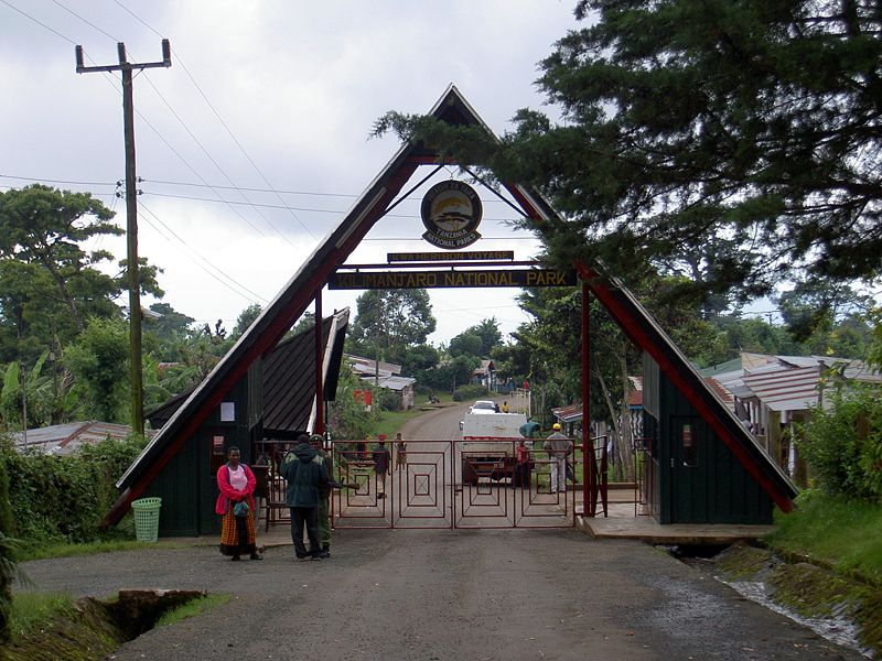
Kilimanjaro. The name itself is a mystery wreathed in clouds. It might mean Mountain of Light, Mountain of Greatness or Mountain of Caravans. Or it might not. The local people, the Wachagga, don't even have a name for the whole massif, only Kipoo (now known as Kibo) for the familiar snowy peak that stands imperious, overseer of the continent, the summit of Africa.


Kilimanjaro, by any name, is a metaphor for the compelling beauty of East Africa. When you see it, you understand why. Not only is this the highest peak on the African continent; it is also the tallest free-standing mountain in the world, rising in breathtaking isolation from the surrounding coastal scrubland – elevation around 900 metres – to an imperious 5,895 metres (19,336 feet).
Kilimanjaro is one of the world's most accessible high summits, a beacon for visitors from around the world. Most climbers reach the crater rim with little more than a walking stick, proper clothing and determination. And those who reach Uhuru Point, the actual summit, or Gillman's Point on the lip of the crater, will have earned their climbing certificates.
And their memories.
But there is so much more to Kili than her summit. The ascent of the slopes is a virtual climatic world tour, from the tropics to the Arctic.
Even before you cross the national park boundary (at the 2,700m contour), the cultivated footslopes give way to lush montane forest, inhabited by elusive elephant, leopard, buffalo, the endangered Abbot’s duiker, and other small antelope and primates. Higher still lies the moorland zone, where a cover of giant heather is studded with otherworldly giant lobelias.
Above 4,000m, a surreal alpine desert supports little life other than a few hardy mosses and lichen. Then, finally, the last vestigial vegetation gives way to a winter wonderland of ice and snow – and the magnificent beauty of the roof of the continent.
About Kilimanjaro National Park
Size: 1668 sq km 641 sq miles).
Location: Northern Tanzania, near the town of Moshi.
Getting there
128 km (80 miles) from Arusha.
About one hour’s drive from Kilimanjaro airport.
What to do
Six usual trekking routes to the summit and other more-demanding mountaineering routes.
Day or overnight hikes on the Shira plateau. Nature trails on the lower reaches.
Trout fishing.
Visit the beautiful Chala crater lake on the mountain’s southeastern slopes.
When to go
Clearest and warmest conditions from December to February, but also dry (and colder) from July-September.
Accommodation
Huts and campsites on the mountain.
Several hotels and campsites outside the park in the village of Marangu and town of Moshi.


NOTE:
Climb slowly to increase your acclimatisation time and maximise your chances of reaching the summit.
To avoid altitude sickness, allow a minimum of five nights, preferably even more for the climb. Take your time and enjoy the beauty of the mountain.


A million wildebeest... each one driven by the same ancient rhythm, fulfilling its instinctive role in the inescapable cycle of life: a frenzied three-week bout of territorial conquests and mating; survival of the fittest as 40km (25 mile) long columns plunge through crocodile-infested waters on the annual exodus north; replenishing the species in a brief population explosion that produces more than 8,000 calves daily before the 1,000 km (600 mile) pilgrimage begins again.

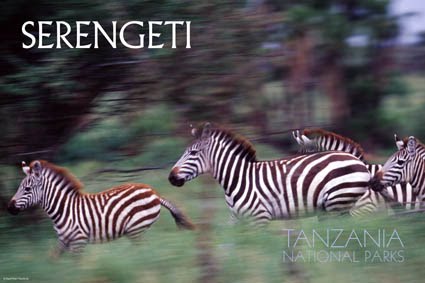
Tanzania's oldest and most popular national park, also a world heritage site and recently proclaimed a 7th world wide wonder, the Serengeti is famed for its annual migration, when some six million hooves pound the open plains, as more than 200,000 zebra and 300,000 Thomson's gazelle join the wildebeest’s trek for fresh grazing. Yet even when the migration is quiet, the Serengeti offers arguably the most scintillating game-viewing in Africa: great herds of buffalo, smaller groups of elephant and giraffe, and thousands upon thousands of eland, topi, kongoni, impala and Grant’s gazelle.
The spectacle of predator versus prey dominates Tanzania’s greatest park. Golden-maned lion prides feast on the abundance of plain grazers. Solitary leopards haunt the acacia trees lining the Seronera River, while a high density of cheetahs prowls the southeastern plains. Almost uniquely, all three African jackal species occur here, alongside the spotted hyena and a host of more elusive small predators, ranging from the insectivorous aardwolf to the beautiful serval cat.

But there is more to Serengeti than large mammals. Gaudy agama lizards and rock hyraxes scuffle around the surfaces of the park’s isolated granite koppies. A full 100 varieties of dung beetle have been recorded, as have 500-plus bird species, ranging from the outsized ostrich and bizarre secretary bird of the open grassland, to the black eagles that soar effortlessly above the Lobo Hills.
As enduring as the game-viewing is the liberating sense of space that characterises the Serengeti Plains, stretching across sunburnt savannah to a shimmering golden horizon at the end of the earth. Yet, after the rains, this golden expanse of grass is transformed into an endless green carpet flecked with wildflowers. And there are also wooded hills and towering termite mounds, rivers lined with fig trees and acacia woodland stained orange by dust.
Popular the Serengeti might be, but it remains so vast that you may be the only human audience when a pride of lions masterminds a siege, focussed unswervingly on its next meal.

About Serengeti
Size: 14,763 sq km (5,700 sq miles).
Location: 335km (208 miles) from Arusha, stretching north to Kenya and bordering Lake Victoria to the west.
Getting there
Scheduled and charter flights from Arusha, Lake Manyara and Mwanza.
Drive from Arusha, Lake Manyara, Tarangire or Ngorongoro Crater.

What to do
Hot air balloon safaris, walking safari, picnicking, game drives, bush lunch/dinner can be arranged with hotels/tour operators.  Maasai rock paintings and musical rocks.
Visit neighbouring Ngorongoro Crater, Olduvai Gorge, Ol Doinyo Lengai volcano and Lake Natron's flamingos.
When to go
To follow the wildebeest migration, December-July. To see predators, June-October.
Accommodation
Four lodges, six luxury tented camps and camp sites scattered through the park; one new lodge will be opened next season (Bilila Lodge); one luxury camp, a lodge and two tented camps just outside.


NOTE
The route and timing of the wildebeest migration is unpredictable. Allow at least three days to be assured of seeing them on your visit - longer if you want to see the main predators as well.

http://www.tanzaniaparks.com/serengeti.html

Mikumi National Park


Swirls of opaque mist hide the advancing dawn. The first shafts of sun colour the fluffy grass heads rippling across the plain in a russet halo. A herd of zebras, confident in their camouflage at this predatory hour, pose like ballerinas, heads aligned and stripes merging in flowing motion.
Mikumi National Park abuts the northern border of Africa's biggest game reserve - the Selous – and is transected by the surfaced road between Dar es Salaam and Iringa. It is thus the most accessible part of a 75,000 square kilometre (47,000 square mile) tract of wilderness that stretches east almost as far as the Indian Ocean.
The open horizons and abundant wildlife of the Mkata Floodplain, the popular centrepiece of Mikumi, draw frequent comparisons to the more famous Serengeti Plains.
Lions survey their grassy kingdom – and the zebra, wildebeest, impala and buffalo herds that migrate across it – from the flattened tops of termite mounds, or sometimes, during the rains, from perches high in the trees. Giraffes forage in the isolated acacia stands that fringe the Mkata River, islets of shade favoured also by Mikumi's elephants.
Criss-crossed by a good circuit of game-viewing roads, the Mkata Floodplain is perhaps the most reliable place in Tanzania for sightings of the powerful eland, the world’s largest antelope. The equally impressive greater kudu and sable antelope haunt the miombo-covered foothills of the mountains that rise from the park’s borders.
More than 400 bird species have been recorded, with such colourful common residents as the lilac-breasted roller, yellow-throated longclaw and bateleur eagle joined by a host of European migrants during the rainy season. Hippos are the star attraction of the pair of pools situated 5km north of the main entrance gate, supported by an ever-changing cast of waterbirds.
About Mikumi National Park
Size: 3,230 sq km (1,250 sq miles), the fourth-largest park in Tanzania, and part of a much larger ecosystem centred on the uniquely vast Selous Game Reserve.
Location: 283 km (175 miles) west of Dar es Salaam, north of Selous, and en route to Ruaha, Udzungwa and (for the intrepid) Katavi. .
How to get there
A good surfaced road connects Mikumi to Dar es Salaam via Morogoro, a roughly 4 hour drive.
Also road connections to Udzungwa, Ruaha and (dry season only) Selous.
Charter flight from Dar es Salaam, Arusha or Selous. Local buses run from Dar to park HQ where game drives can be arranged.
What to do
Game drives and guided walks. Visit nearby Udzungwa or travel on to Selous or Ruaha.
When to go
Accessible year round.
Accommodation
Two lodges, three luxury tented camps, three campsites.
Guest houses in Mikumi town on the park border. One lodge is proposed at Mahondo and one permanent tented camp at Lumaaga

http://www.tanzaniaparks.com/mikumi.html

Wednesday, April 28, 2010

What is in the Ngorongoro Crater?

The Ngorongoro Crater


What is the Ngorongoro Crater?

The Ngorongoro Crater is the remains of a once massive volcano, nearly three million years old, on the eastern border of the Serengeti National Park. Now collapsed and eroded to leave the world's largest unbroken caldera, it forms an extraordinarily fertile ‘bowl’ in the midst of rolling highlands, with permanent water sources and steep sides ensuring that the wildlife that thrives here has little reason to leave.

Situated in the midst of the Ngorongoro Conservation Area, a wildlife preservation area roughtly the size of Crete, the crater forms an important aspect of the northern Tanzania safari circuit.
Ngorongoro Safaris and Wildlife

The crater is the spectactular stalking ground of around 20,000 to 30,000 wild animals at any one time, the most densely packed concentration of wildlife in Africa. The crater thus holds an astonishing microcosm of East African wildlife within its boundaries, and thus has achieved renown as 'the eighth wonder of the world', and attracts a growing number of visitors each year.


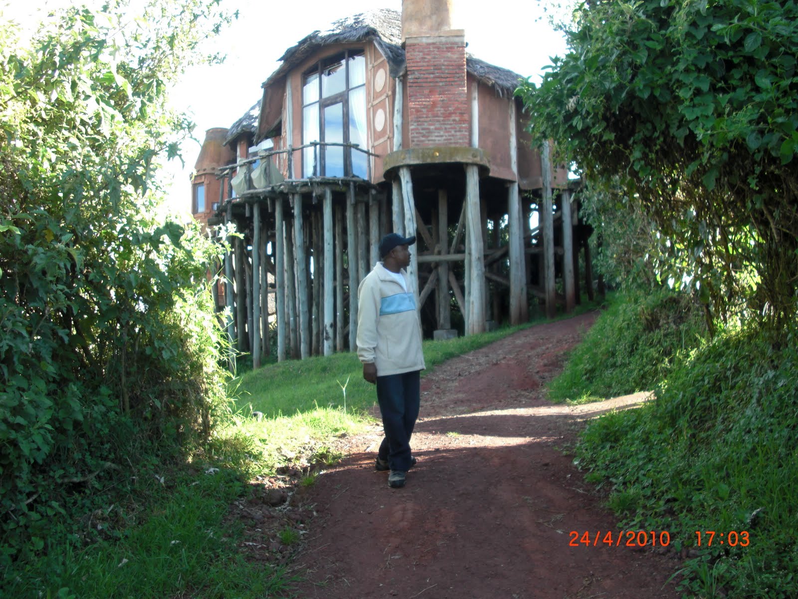
VIEW OF NGORONGORO CRATER LODGE  SITUATED  AT THE CRATER VIEW
In order to preserve the quality of the experience and the environment, measures have had to be taken to limit the number of people inside the crater at any one time, and safaris are now limited to one per day for each vehicle either as a morning or an afternoon trip. It remains a rewarding safari location, even when time is limited.
Ngorongoro Crater Habitats and Highlights


VIEW OF NGORONGORO CRATER SAFARI SHOP PRODUCTS
The Crater comprises areas of grassland, swamps, lerai forest (small patches of forest made up of yellow-barked acacia and yellow fever trees), and Lake Makat, a central soda lake filled by the Munge river.

These habitats attract all kinds of wildlife to drink, wallow, graze or hide, and although the animals are free to move in and out of this contained environment, the rich volcanic soil, lush forests and spring-fed lakes on the crater floor incline both grazers and predators to remain.


A VIEW OF NGORONGORO CRATER
Ngorongoro Crater is one of the last remaining areas in Tanzania where you are likely to see the endangered Black Rhino: a small population is thriving in this idyllic and protected environment, and it remains one of the few areas where they continue to breed in the wild.

Tarangire National Park

Tarangire National Park has some of the highest population density of elephants anywhere in Tanzania, and its sparse vegetation, strewn with baobab and acacia trees, makes it a beautiful and special location. Located just a few hours drive from the town of Arusha, Tarangire is a popular stop for safaris travelling through the northern circuit on their way to Ngorongoro and the Serengeti. The park extends into two game controlled areas and the wildlife are allowed to move freely throughout.

Before the rains, droves of gazelle, wildebeest, zebra, and giraffes migrate to Tarangire National Park’s scrub plains where the last grazing land still remains. Tarangire offers unparalleled game viewing, and during the dry season elephants abound. Families of the pachyderms play around the ancient trunks of baobab trees and strip acacia bark from the thorn trees for their afternoon meal. Breathtaking views of the Masaai Steppe and the mountains to the south make a stop at Tarangire a memorable experience.

Ngorongoro Crater- The pride of Tanzania

Ngorongoro Crater

The Ngorongoro Crater is often called ‘Africa’s Eden’ and the ‘8th Natural Wonder of the World,’ a visit to the crater is a main drawcard for tourists coming to Tanzania and a definite world-class attraction. Within the crater rim, large herds of zebra and wildebeest graze nearby while sleeping lions laze in the sun. At dawn, the endangered black rhino returns to the thick cover of the crater forests after grazing on dew-laden grass in the morning mist. Just outside the crater’s ridge, tall Masaai herd their cattle and goats over green pastures through the highland slopes, living alongside the wildlife as they have for centuries.

Ngorongoro Conservation Area includes its eponymous famous crater, Olduvai Gorge, and huge expanses of highland plains, scrub bush, and forests that cover approximately 8300 square kilometres. A protected area, only indigenous tribes such as the Masaai are allowed to live within its borders. Lake Ndutu and Masek, both alkaline soda lakes are home to rich game populations, as well as a series of peaks and volcanoes and make the Conservation Area a unique and beautiful landscape. Of course, the crater itself, actually a type of collapsed volcano called a caldera, is the main attraction. Accommodation is located on its ridges and after a beautiful descent down the crater rim, passing lush rain forest and thick vegetation, the flora opens to grassy plains throughout the crater floor. The game viewing is truly incredible, and the topography and views of the surrounding Crater Highlands out of this world.

This truly magical place is home to Olduvai Gorge, where the Leakeys discovered the hominoid remains of a 1.8 million year old skeleton of Australopithecus boisei, one of the distinct links of the human evolutionary chain. In a small canyon just north of the crater, the Leakeys and their team of international archaeologists unearthed the ruins of at least three distinct hominoid species, and also came upon a complete series of hominoid footprints estimated to be over 3.7 million years old. Evacuated fossils show that the area is one of the oldest sites of hominoid habitation in the world.

The Ngorongoro Crater and the Ngorongoro Conservation Area are without a doubt some of the most beautiful parts of Tanzania, steeped in history and teeming with wildlife. Besides vehicle safaris to Ngorongoro Crater, Olduvai Gorge, and surrounding attractions, hiking treks through the Ngorongoro Conservation Area are becoming increasingly popular options. Either way you choose to visit, the Crater Highlands are an unforgettable part of the Tanzanian experience.

Saturday, April 24, 2010

ABOUT TANZANIA

United Republic of Tanzania
Jamhuri ya Muungano wa Tanzania

Flag Coat of arms

Motto: "Uhuru na Umoja" (Swahili)
"Freedom and Unity"
Anthem: Mungu ibariki Afrika
"God Bless Africa"


Capital Dodoma
Largest city Dar es Salaam
Official language(s) Swahili (de facto)
English (Higher courts, higher education)[1]
Demonym Tanzanian
Government Republic
- President Jakaya Kikwete
- Prime Minister Mizengo Pinda
Independence from the United Kingdom
- Tanganyika 9 December 1961
- Zanzibar 12 January 1964
- Merger 26 April 1964
Area
- Total 945,203 km2 (31th)
364,898 sq mi
- Water (%) 6.2
Population
- 2009 estimate 43,739,000[2] (32nd)
- 2005 census 37,445,392
- Density 46.3/km2 (124th)
119.9/sq mi
GDP (PPP) 2009 estimate
- Total $57.400 billion[3]
- Per capita $1,416[3]
GDP (nominal) 2009 estimate
- Total $22.318 billion[3]
- Per capita $550[3]
Gini (2000–01) 34.6 (medium)
HDI (2008) ▲ 0.530 (medium) (151st)
Currency Tanzanian shilling (TZS)
Time zone EAT (UTC+3)
- Summer (DST) not observed (UTC+3)
Drives on the left
Internet TLD .tz
Calling code +2552
1 Estimates for this country explicitly take into account the effects of excess mortality due to AIDS; this can result in lower life expectancy, higher infant mortality and death rates, lower population and growth rates, and changes in the distribution of population by age and sex than would otherwise be expected.
² 007 from Kenya and Uganda.

Coordinates: 6°18′25″S 34°51′14″E / 6.307°S 34.854°E / -6.307; 34.854 The United Republic of Tanzania (pronounced /ˌtænzəˈniːə/; Swahili: Jamhuri ya Muungano wa Tanzania)[4] is a nation in central East Africa bordered by Kenya and Uganda to the north, Rwanda, Burundi and the Democratic Republic of the Congo to the west, and Zambia, Malawi and Mozambique to the south. The country's eastern borders lie on the Indian Ocean.

The United Republic of Tanzania is a unitary republic composed of 26 mikoa (regions).[5] The current head of state is President Jakaya Mrisho Kikwete, elected in 2005. Since 1996, the official capital of Tanzania has been Dodoma, where parliament and some government offices are located. Between independence and 1996 the major coastal city of Dar es Salaam had been the country's political capital. Today Dar es Salaam remains the principal commercial city of Tanzania and the de-facto seat of most government institutions.It is the major seaport for the country and its landlocked neighbours.

The name Tanzania is a portmanteau of Tanganyika and Zanzibar. The two states united in 1964 to form the United Republic of Tanganyika and Zanzibar, which later the same year was renamed the United Republic of Tanzania.[5]